HUNAGI Napló legutóbbi látogatói

Címkék

#SDG11 14. ICGC 2030 Agenda 20th ISDE 3D 3D city modelling 3D city models 3D SIG 4-es metró 5. Digital Earth Summit 5. Térinformatikai Konferencia és Szakkiállítás 6th Digital Earth Summit 7 ICC&GIS adatpolitika Afrika Expo és Vásár Agenda 2030 AGEO AGILE AGILE 2014 Agile 2015 AGILE 2017 AGIT AGIT Expo Agrárinformatika Agriculture AgriFuture Appathon ARSET ASGC Atlas Human Planet 2018 Award Bernhard Harzer Verlag Best Practice BiDS 14 Big Data Big Data from Space Big Spatial Data BIM biodiversity BKK BME BME ÁGT BME VIK EIT BMWi Cadastre 2.0 CAGI cartographic heritage Cascadoss CeDEM Center for Open Data Enterprise CEODE CEOS CEOS WGISS CGS Chubu citySDK CitySmart CLGE CME CODATA conservation COP23 Copernicus Copernicus Masters Copernicus MPP CORP 2017 CORP2017 COSPAR COSPAR 2014 CSIRO Danube Data Cube Danube Participation Day of the Danube Strategy Danube Reference Data Service Infrastructure Danube_Net Data Archives Data Curation Data Documentation Initiative Data Economy data policy DCH2017 DDI DE Summit DE TGT Debrecen Debreceni Egyetem Földtudományi Intézet Defense Defense imagery Information Deqing DES 2018 DGI Digital Approaches to Cartographic Heritage Digital cartography digital cultural heritage Digital Earth Digital Earth in a Transformed Society Digital Earth Session Digital Earth Summit Digital Earth Summit 2016 Digital Earth Symposium Digital Map Heritage Digital repository Digitális Föld Digitális Föld Csúcs Digitális kulturális örökség digitális térképi örökség Disaster Disaster management Disaster Risk Disaster risk assessment DLR Doha Draught Risk Management DRDS DRDSI drones Drónok Duna Adatkocka Duna Stratégia Duna-régió Stratégia DUT e-Government e-learning courses EuroSDR EARSeL ECAI ECAI PNC ecosystems éghajlatváltozás élelmiszerbiztonság ELF ELTE ELTE IK TGT ELTE TGT ENSZ ENSZ Klíma Csúcs Environment EO EO4Alps EO4climate EO4SDG EoE EoE webinar ESA ESA ESRIN ESD ESDI-NET ESDINET ESPON Esri Esri Magyarország ESRIN Ethical reuse of data EU EU BIG IoT EU citySDK EU Data Innovation Forum EU Space Imaging EUGEO EUGEO2017 EULF EULIS EURISY EuroGeo EuroGEOSS EuroGEOSS broker EUROGI European Cohesion Policy European Lidar Mapping Forum European Space SolutionsKép: EuroSDR EuroSDR 3D EuroSDR JRC EUSDR Eye on Earth Eye on Earth Symposium Eye on Earth webinar fenntartható fejlődés FÉNY - TÉR - KÉP 2017 FÉNY-TÉR-KÉP FÉNY-TÉR-KÉP 2016 FÉNYKÉP FÉNYKÉP TÉRKÉP FET FF célok FFC FGDC FI Working Week 2017 FIG FIG Hanoi FIG Helsinki FIG Working Week FIG Working Week 2017 Föld-rendszer földhasználat földmegfigyelés földművelés földtudomány FÖMI FOSS Academy FOSS4G FOSS4G 2016 FOSS4G 2017 FOSS4G 2018 FOSS4G HU FOSS4G-Asia FOSS4G-Europe FOSS4G-HU FOSS4G.HU Foszforgézu Foszforgézúúúú Fotogrammetria Future Internet FuturICT Galway GaphiTech GCOS GDI Fórum GDI Sachsen Geiger-Mode LiDAR GEO GEO Business 2014 GEO Data and Knowledge Week GEO Data Providers Geo Delft 2018 GEO European Projects GEO Exhibit GEO Week 2017F GEO Week 2018 GEO XI Geo-ethics Geo-etika Geo-IT Geoadat GeoBIM GeoBIM Europe GeoBusiness GeoBusinessFORUM Geographic Information Science Geography of Europe Geoinformatics 2016 Geoinformatics Potsdam geoinformatika gazdaság geoinformatikai piac GeoIQ GEOMAT 2014 Geonovum Geoscience Australia Geospatial data Geospatial Intelligence Geospatial Summit Geospatial World Forum Geospatial World Forum 2016 Geospatial World Forum 2017 GEOSS GeoSUR GI EO SDG GI Forum GI Humanitarian Assistance GI services GI_Forum 2015 GI-18 GI-Forum GIM International Summit GIS GIS Open 2017 GIS Ostrava GIS Ostrava 2016 GIS-education Gisday GISopen GISopen 2016 GISopen 2017 grid computing Clouds GSDI GSTIC GWF GWF 2016 H-SPACE 2017 H2020 Health Helmholtz-Zentrum für Umweltforschung heritage management Hexagon Horizon 2020 HUNAGI HUNAGI ISPIK HUNGEO 2014 HUNSPACE HxGN HxGN 2015 ICA ICA-OSGEO ICC&GIS ICSU ICSU CODATA ICT ICT Family Farming Ideal-IST IDEAS IGARSS IGIT IGIT 2005 IJDE ILUS 2019 imaGIne 2 Indicator reporting Információs Társadalom Parlamentje information age Infotér Infotér 2014 Infoterra Innotrends 2014 Innovation INSPIRE INSPIRE 2014 INSPIRE 2015 INSPIRE 2016 INSPIRE konferencia 2016 INSPIRE validation Intelligens városok INTERGEO 2011 Intergeo 2014 INTERGEO 2015 Intergraph International Map Year Internet of Things interoperabilitás interoperability Interspect IoT IRIS ISA ISDE ISDE 9 ISDE Digital Earth European Chapter ISDE Florence ISDE10 isde7 ISDE9 ISEH ISGC 2016 ISPRS ISPRS kongresszus ISPRS Prága ISPRS XXIII Congress ITP JAXA Jövő internet JRC Kartografija.hr Kartverket Katasztrófa menedzsment képfeldolgozás Kereskedelmi lehetőségek Afrikában knowledge kockázatelemzés Kommission für Geoinformationswirtschaft KRF KU Leuven Landsat laser scanning LBS Leica Library Library Information Lidar Lidar 2014 LIDAR forestry lidar mapping Lipszy János LISC75 Living Planet Living Planet 2016 Locate17 MAGISZ Magyar Földrajzi Napok MANT Mapinfo MFGVE MFT MFTTT Mitteldeutschen GEOforum MMK-GGT mobility MTA SZTAKI MŰI Mundo GEO Museum Allience MUT Nagy Adatok NAIH NASA NASA ARC NASA World Wind népességnövekedés Next GEOSS Next GEOSS training NextGEOSS NHIT NIH NMCA NMCA Summit NMHH Norvég Alap NRC nyfsz NyME GEO Oblique Aerial Camera Systems ODC ÓE AMK OGC OGRS okos város Del Bianco CitySmart OMSZ Open data Open data business models Open Data Cube Open Geodata Open Government Data open source Open source Geospatial Open source Geospatial Education Open source Geospatial Research Open source Open data Open Standards for BIM OSGeo OSGeo Lab Budapest Ossiach Klub OSZK Paris Agreement Patrick Hogan Pitney Bowes Software Plan4all PNC 2016 Prof. Carsten Jürgens QGIS QGIS HackFest RADI Rasdaman RDA REAL CORP 2017 Recovery Regional Development remote sensing Resource Watch RESTEC Road to dignity RPAS RT&I Sächsisches GIS-Forum SAGI SAR for mapping SatCen SD SDG SDG Academy SDG National Reporting SDG reporting SDGs SDI SDI Day SEE sensor web Sentinel Sentinel-2 Smart cities Smart City smarter cities smeSpire Societal Geo-Innovation Socioeconomic potential of Land Administration Services spatial planning SPL LiDAR Strategy on SDG National Reporting STSN Sustainable City Swiss Data Cube szenzor háló Szép Magyar Térkép Szép magyar térkép 2015 Szép Magyar Térkép 2016 Tabula Hungariae társadalmasítás távérzékelés téradatok üzleti modellek térinformatika Térinformatika oktatása Térinformatikai Konferencia TÉRKÉP Térképészet térszkennelés Törökbálint Travel Award DES 2018 UAS UAV ubiquitous e-infrastructure UHI UN 2030 Agenda UN Agenda 2020 UN Climate Summit UN SDSN UN-GGIM UN-SPIDER UNIGIS Summer School University of Geneva UNOOSA UNWGIC Urban Remote Sensing Urban transitions Űripar űrkutatás VARINEX városi hősziget városiasodás várostervezés Versenyképesség VGI Wageningen WDS We Act4SDGs Webinar European Location Framework WGISS WGISS 46 Wo? kongresszus World Summit Information Society WPLA WSIS WWEC WWEC 2014 WWEC 2015 WWEC 2016 WWEC 2017 WWEC Helsinki Z_GIS

Monday, October 29, 2012

Közeleg az AGILE előadásbejelentkezés határideje!

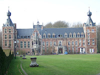
Az építészkar épülete Leuvenben. HUNAGI fotó, 2009
Mai postánkból! Köszönet Ludo Engelennek, a HUNAGI közösség számára végzett rendszeres tájékoztatásáért.
(Egyébként jó lenne tudni, mely honi szervezetek tagjai az AGILE-nek és van-e az AGILE kapcsolatoknak magyar felelőse mert ha igen, hasznos lenne az együttműködése a HUNAGI-val, hogy a magyar részvétel erősítése érdekében szervezetünk hatékonyan közre tudjon működni.). Világos, hogy az ismeretek, lehetőségek terjsztése napjainkban nem hogy az egyetemeke és főiskolákon, de aközép- és általános iskolákban kell kezdődjön, természetesen mgfelelő kommunikációs eszközökkel.)
"Dear AGILE members,
This is a reminder for the call for papers for next years’ AGILE Conference which will take place in Leuven, 14-17 May
We want to draw your attention that the guidelines of Springer changed somehow as compared to AGILE 2012. See the AGILE 2013 website for more information.

9 November 2012 is the deadline for submission of full papers for the Springer book.

Danny, Joep and Bénédicte
Chairs AGILE 2013 Programme Committee"
A felhívás itt folytatódik:

Tuesday, October 23, 2012

Infotér Konferencia Balatonfüred, 2012. november 8-9.

A 3. Informatika a Társadalomért Konferencia kerekasztal programrészében elődói felkérést kapott Barkóczi Zsolt, a HUNAGI elnöke is. Az előzetes program amint publikus, innen is letölthető lesz. 

Tudomány a levegőből - nemzetközi jelentőségő konferencia Gyöngyösön

Tagszervezetünk a Károly Róbert Főiskola nemzetközi jelentőségű rendezvényt szervez 2012. november 6-ra.
Azon előad többek között a Magyar Tudományos Akadémia főtitkára és az ENSZ OOSA programigazgatója is. Dr. Tomor Tamás intézetigazgató értesítése nyomán bátorítjuk a HUNAGI tagintézményeit, tagszevezeteit  és partnereinket a részvételre.
Letölthető program

Monday, October 22, 2012

OECD 2012 Technológia Előretekintés Fórum

Postánkból. Az elmúlt héten, távollétemben érkezett meg Christian Reimsbach-Kounatze úrnak, az OECD információs gazdaság/politika elemzőjének levele a Big Data témakörben, melynek alábbi bekezdése egy mai eseményre hívja fel a figyelmet:

logo_mail_uk"You may also be interested in the 2012 Technology Foresight Forum, which will take place in 22 October 2012 in Paris and will focus on data analytics for harnessing the socio-economic value of data and their impacts on fundamental values such as privacy and freedom. You will find more information about the Foresight Forum (including the agenda) under http://oe.cd/tff2012.
Please let us know if you would like to join the Forum, or if you have any questions regarding our work on big data."
Bár a hírnök a csata után érkezett az egyhetes Internet-távollétem miatt, a Fórum témája és eredménye  érdekes lehet a LAPSI  2.0 szempontjából is.

Sunday, October 21, 2012

Október 24-26: MITIP


Postánkból:
"MITIP2012
     Scientific Forum and Proposers’ Day     
24-26 October, Budapest


Dear Colleague,

Please find attached the updated, final conference program. Please note that we have introduced several changes compared to the previous version, in order to accommodate received requests.

REMINDER:
1. Presenters of proposal ideas
The number at the end of the code received determines the order of the presentations.
Please use the code when naming the slides you are preparing and either a.) send the slides of your presentation to me one day in advance of the event, OR b.) bring it on a pendrive (not CD, DVD!) and on the event day hand it to me on the very first coffee break.
After the event, a special folder will be accessible (with password) to the participants, therefore on the very last slide of your presentation please include the following sentence, IF the case: “I wish this presentation to be made accessible to event participants on the common MITIP folder” (slides missing this sentence will not be uploaded). Thank you.

2. Presenters of scientific contributions
The program features the session chairs, respectively the rooms where the presentations will be held. Please hand over to your session chair the slides of your presentation before the start of the session, thank you.


Wishing you all a safe trip to Budapest and looking very much forward to welcome you next week,
Elisabeth

-----------------------------------------------------------
Dr. Elisabeth Ilie-Zudor, PhD
Head, Intelligent Information Management
Research Laboratory of Engineering and Management Intelligence
Computer and Automation Research Institute, Hungarian Academy of Sciences
Phone: (+36 1) 2796195"

Friday, October 12, 2012

GISIG közgyűlés és BRISEIDE projekt zárótalálkozó


Mai postánkból: "...The next GISIG General Assembly which will be held in Povo, Trento (IT) on Octoberber 29th, 2012 at 17:30 CET  at the premises of the Conference “Space and Time - Enhancing resilience of communities and territories through smart technologies” ...
The Conference is organized by the GISIG member Graphitech Foundation as final event of the project BRISEIDE (www.briseide.eu), participated by GISIG also as responsible for dissemination activities.
The topics of the Conference are of interest of the SEIS and INSPIRE Community, for the environment applications that might need the “time” dimension. The active participation by GISIG Members in the Conference would be welcome..."
HUNAGI bíztatja érdeklődő tagszervezeteit, jelezzék, ha részt kívánnának venni a találkozón. HUNAGI-nak lehetősége van GISIG tagként legalább egy tagszervezet részvételét ajánlani.  

Monday, October 8, 2012

LIDAR Térképezés Európai Fórum - október 10-ig még csökkentett áron lehet jelentkezni

Mai postánkból:
"I am writing to remind you that the early bird registration discount for The European LiDAR Mapping Forum 2012 ends on Wednesday 10th October.
For more information or to register, please visit: www.lidarmap.org
We look forward to welcoming you Salzburg in 2012.
Best wishes, The ELMF Team"


Tuesday, October 2, 2012

Információtechnológia -innováció - ipari vállalkozók MITIP okt 24-26 regisztráció

On-line regisztráció: http://www.congress.hu/mitip2012/

Térinformáció etika és GI tudomány - Előadásokat várnak a szervezők

A GSDI jogi és szocioökonomiai bizottsága levelezésében most érkezett dr. Rodolphe Devillerstől:

"Call for papers, AAG 2013, Los Angeles, CA (April 9-13)


"Geographic Information Ethics and GIScience"
Following successful sessions at the 2009-2011 AAG meetings on ethics and GIScience, we are organizing sessions to continue and expand discussions of this important topic. Ethical engagements with the multitude of GIS applications and uses, whether surreptitious or overt, have marked recent developments in the field. Indeed, the variety ofapplications of geographic information science & technology (GIS&T) has led the U.S. Department of Labor to highlight geospatial/geospatial technologies as the third largest high-growth job field for the 21st century.While the potential benefits and risks of geographic technologies are becoming well known, the session provides a forum to engage ethical issues. For instance:
  • geographic technologies are surveillance technologies. The data they produce may be used to invade the privacy, and even the autonomy, of individuals and groups;
  • data gathered using geographic technologies are used to make policy decisions. Erroneous, inadequately documented, or inappropriate data can have grave consequences for individuals and the environment;
  • geographic technologies have the potential to exacerbate inequities in society, insofar as large organizations enjoy greater access to technology, data, and technological expertise than smaller organizations and individuals;
  • georeferenced photos, tweets and volunteered (and unvolunteered) geographic information can reveal private information. Thosedata that are increasingly publically available and used to study societal phenomena raise significant privacy concerns.
Papers in this session engaged with the above issues in relationship to GIScience, including such topics as:
  • case studies, curriculum development, or the pedagogy of teaching GIS ethical issues;
  • issues of privacy, surveillance, inequity, erroneous or inappropriate data concerning geographic technologies;
  • codes of ethics and conduct of professional organizations;
  • GIS professional development;
  • reflections on the changing nature of ethical issues in GIS&T.
These sessions are co-sponsored by the AAG GI Systems & Science and Ethics, Justice, and Human Rights Specialty Groups.
To participate:
  1. Please register for the AAG 2013 meeting and submit your abstract online following the AAG Guidelines (www.aag.or/cs/anualmeeting/call_for_papers);
  2. Please send your paper title, PIN, and abstract no later than Wednesday, October 20 to Rodolphe Devillers rdeville@mun.ca, Francis Harvey fharvey@umn.edu, or Dawn Wright dwright@esri.com

*****************************************************
Rodolphe Devillers, PhD
Associate Professor

Department of Geography
Memorial University of Newfoundland
St. John's (NL) A1B 3X9
Canada
*****************************************************

This electronic communication is governed by the terms and conditions at http://www.mun.ca/cc/policies/electronic_communications_disclaimer_2012.php

_______________________________________________
Legal-Socioecon mailing list
Legal-Socioecon@lists.gsdi.org
http://lists.gsdi.org/mailman/listinfo/legal-socioecon "

HUNAGI Tagok és Partnerek! Kanadai CV/ITS műhely Bécsben, október 22-én, az ITS világkongresszuson

Mai postánkból. Morvai Gergely úr, a Kanadai Nagykövetség kereskedelmi biztosa küldte az alábbi levelet és szakmai figyelemfelhívást:

Tisztelt Remetey Úr!

Hivatkozással mai telefonbeszélgetésünkre tisztelettel meghivjuk Önt és a HUNAGI tagvállalatait a 2012. október 22-én, Bécsben megrendezésre kerülő Connected Vehicle / Intelligent Transportation System Workshop és B2B rendezvényre. A rendezvényt az idén Bécsben megrendezésre kerülő, nagyszabású World ITS Kongresszus megnyitó ünnepségének napján, a megnyitó ünnepséget megelőzően szervezzük. Levelemben mellékeltem a program részletes leirását, a résztvevő kanadai vállalatok rövid bemutatását és a jelentkezési lapot. Részvételi szándékukkal kapcsolatban várjuk szives visszajelzésüket."


INVITATION TO THE CONNECTED VEHICLE WORKSHOP
Monday, 22 October 2012. (08:30-16:30)

Courtyard by Marriott Wien Messe, 1020 Vienna, Trabennstrasse 4.


Dear Mr. Remetey,
The Canadian Embassy to Hungary, Slovenia and Bosnia and Herzegovina cordially invites you and your colleagues to the Connected Vehicle Workshop program, organized by the trade department of the Canadian Embassy in Austria, in context to the world leading international World ITS Conference, held this year in October in Vienna.  http://2012.itsworldcongress.com/content
The Connected Vehicle Workshop is a free-of charge, one-day program, designed for business professionals in Europe with strong focus on research and business development in the connected vehicle and intelligent transportation system technologies.  (IT solutions for parking management, fleet managment, IT based secutity systems, hiway troll systems, logistics IT etc)

Attending the workshop offers a unique opportunity for you to

Monday, October 1, 2012

Előadással jelentkezni lehet a jövő évi sandiegoi Esri felhaszálói konferencia GIScience szekciójába

Mai postánkból: Ludo Engelen (SADL, KU Leuven) kutatás-fejlesztési részlegétől továbbította az AGILE főtitkára alábbi körlevelét:
"Dear AGILE stakeholders,

Please find herewith the Call for Presentations: Special GIScience Research Session, Esri International Users Conference, 8-12 July, 2013, San Diego, California
Kind regards,
Danny Vandenbroucke
---------------------------------------------------------------
Engelen Ludo
KU Leuven, R&D Division SADL
(Spatial Applications Division Leuven)
Celestijnenlaan 200 E, B-3001 Leuven, Belgium
Tel: +32 -16-32 97 32

ludo.engelen (at) sadl.kuleuven.be 
http://www.sadl.kuleuven.be "